Gaining Perspective on the Life of Jesus of Nazareth
You will need Google Earth to do this activity (download it free). Answer all questions marked by ►.
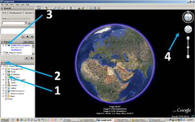
(b) Un-check all boxes in the Layers panel (1). You may wish to minimize the layers panel (2). Click to un-check “All Bible Places” in Places panel (3). Click on plus mark next to “All Bible Places (Chapters)” (3).
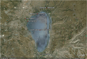
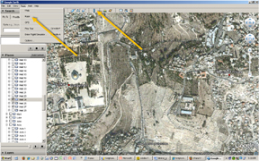
(c) Click plus next to “All Bible Places (Chapters)” (3 above). Click on the box next to Mark putting a check in it. Next, adjust altitude so that the Sea of Galilee fills most of the screen (see illustration on left, below). Orient the map using the mouse: point and click to move map, scrolling wheel adjusts altitude. Alternatively, use the tools in the upper right part of the screen (4 above). Click on the red dot on the map (yellow arrows in illustration on right, below) to make a list of verse references appear, and click on some of the the verses in the pop up boxes (blue arrow in illustration or right, below) to read of some of the numerous miracles Jesus performed in the cities and villages. Now, un-check the box next top Mark, then click the plus next to Matthew, and put a check in Matt 11. Click on Chorazin’s red dot and open up its verse (Matt 11:21). ► How does the close proximity of Chorazin to the other villages in the region where Jesus had performed a large number of miraculous signs inform your understanding of Matthew 11:21?
 |  |
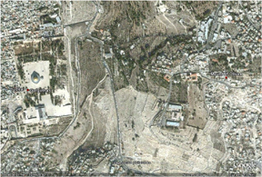
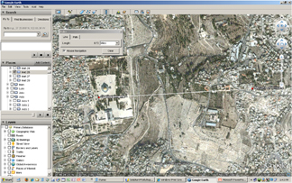
(d) In Google Earth un-check anything from the previous point, and close the verse panel if it is still open. Now, click the plus next to Matthew to reveal the chapters, and put check marks in Matt 24, Matt 26, and Matt 27. Next, move the screen and zoom in until Jerusalem/Golgotha is on the left and the Mount of Olives is on the right (see illustration on left, below). From the drop-down “Tools” menu at the top of the screen select “Ruler” or use the "Ruler icon on the toolbar (see illustration on right, below) -- be sure it is set on miles and mouse navigation.
 |  |
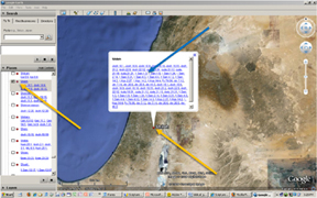
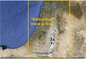
Click on Jerusalem/Golgotha and then stretch the line to the Mount of Olives to see how far apart they are (see illustration on the left, below). Read Matthew 24:1-3, keeping in mind that the Mount of Olives is higher up looking over the temple area—this is an important setting for this discourse. ► What the distance between Jerusalem/Golgotha and the Mount of Olives? Next, zoom up high enough to see all of biblical Israel (illustration right, below), and measure the distance between Nazareth and Jerusalem, and between the Mediterranean Sea and the Sea of Galilee. ► What the distance between them? Think about the size of the region of Jesus’ life and ministry. ► How does it compare to Connecticut or New Jersey?
 |  |
(e) If you wish to save your work, click “Edit” drop-down menu on the upper toolbar, and click “Copy Image.” Next, open an image editing program and paste the image (like Pp).
Copyright © 2009 ScriptureWorkshop.com
Return to The Biblical Geography Workshop